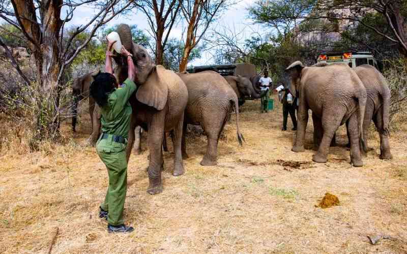
Keepers at Reteti Elephant Sanctuary feed baby elephants with goat milk during feeding time. [Maryann Muganda, Standard]
×

The Standard e-Paper
Join Thousands Daily

Audio By Vocalize
A month ago, in January 2026, a Global Positioning System (GPS) collar signalled that a 24-year-old elephant matriarch, Liana, had left Samburu National Reserve. She moved west, then south, across the landscape linking the Samburu and Laikipia ecosystems
Motion cameras captured her and her family passing through Ol-Donyiro, along a corridor that thousands of herds have followed for generations. Leading her herd, she tracked water, forage and safety, guided not by policy documents but by ancestral memory passed down through generations.
Her route cuts across conservation zones, pastoral land and political boundaries. That movement must be negotiated carefully and protected at all costs.
This is the recurring story of Kenya’s northern rangelands. Rainfall no longer arrives with former predictability. Rivers and ponds swell and vanish; wells fail; pastures green unevenly. It is an unforgiving environment for any form of life that does not adapt. Adaptation must now frame conservation, environmental stewardship and sustainable livelihoods for local communities.
When systems governing the delicate balance between humans, wildlife and livestock falter, the cost falls hardest on those closest to the land. Families in Oldonyiro and the wider Isiolo landscape have lost livestock to drought, crops to elephants moving beyond constrained dry-season ranges and, in some cases, relatives to human–wildlife conflict. The economic strain is not abstract.
Benjamin Loloju, a resident of Ol-Donyiro, grazes his livestock a few metres from Liana’s migratory path. For years, the absence of a structured governance framework meant this proximity was managed by chance, tolerance and occasional tragedy rather than policy. That is the baseline against which progress must be measured.
Conservation has historically relied on fixed boundaries: fenced parks, reserves, conservancies and exclusion zones. Across northern Kenya and other wildlife-rich regions, this model assumed ecological stability and a minimal human footprint. It is presumed that ecological rhythms would oscillate within a narrow band of historical memory. Under accelerating climate stress, that assumption is failing and demands urgent intervention. Wildlife does not respect static lines when water and forage shift beyond them.
Elephants illustrate this with uncompromising clarity. They respond to gradients of water, forage and safety. When drought intensifies, they extend their range. When corridors are blocked, they do not retreat because a strategy was drafted in a boardroom. They push through farms, settlements, fences, roads and railways.
Climate change has transformed variability into volatility. Movement is no longer a seasonal adjustment; it is a survival strategy for humans and wildlife alike. Recognising this intertwined existence — shared ecological stress and competition for water and grazing — is essential to crafting durable solutions.
Migratory corridors are not merely wildlife amenities. They are climate infrastructure: a hydrological logic made visible on land, akin to transport networks for people. They enable water, grazing pressure, livestock and wildlife to redistribute under stress rather than accumulate at boundaries until conflict erupts.
The most credible corridor designs in northern Kenya are not wildlife-only interventions. They are dual-purpose systems, functional for elephant movement as well as pastoral livestock and community access. This is not a political compromise; it is a technical necessity in a landscape shared by humans and wildlife under identical climate pressures. When a corridor serves both Liana’s ancestral route and Loloju’s grazing needs, it becomes politically durable in a way a wildlife-only designation never could.
In January 2025, the Isiolo County Government partnered with communities and stakeholders to initiate the gazettement of sections of three wildlife corridors linking the Marsabit, Samburu, Isiolo, Laikipia and Mount Kenya ecosystems. The initiative was finalised in February 2026 within the Physical and Land Use Development Plan for Ol-Donyiro town.
Sections passing through and around the town were identified as choke points, which, unless secured in law, risked blocking the corridors. Embedding them in the statutory plan created a powerful policy instrument guiding land use and governance, one that cannot be overridden without triggering formal review involving all stakeholders. The corridors now sit within the same legal architecture as roads, utilities and settlement zones. They can be invoked and defended.
When a wildlife corridor is embedded in a spatial plan, it gains standing in governance processes from which it would otherwise be excluded. Community members and government agencies now possess a legal instrument to defend its integrity. In concrete terms, this marks the beginning of what is often described but rarely achieved: a lasting solution.
Several factors made this outcome possible: national policy frameworks anchored in the 2010 Constitution, political goodwill, including a 2023 Presidential Directive to preserve wildlife corridors, scientific evidence reinforcing local knowledge of movement patterns and sustained community engagement.
GPS collar data from elephants, such as Liana provided spatial evidence used by county planners and surveyors to designate corridor boundaries and legal protection. The process effectively listened to what Liana’s herd was signalling and granted that message the weight of law.
Stay informed. Subscribe to our newsletter
Local pastoralists, who have herded these rangelands for generations, contributed knowledge of seasonal movements that satellites cannot detect. They engaged in repeated dialogue, sharing expertise while trusting the process would safeguard their socio-economic and cultural interests alongside those of wildlife.
Trust is not freely given in landscapes where much has been promised and little delivered. County planners understood that getting it right mattered more than speed. This is where conservation truly happens: not merely in policy documents, but in the human architecture sustaining them over time.
Kenya’s 2017 Wildlife Migratory Corridors and Dispersal Areas report, a deliverable of Kenya Vision 2030, called for integrating wildlife connectivity into statutory planning. The Ol-Donyiro town plan has now achieved that at the county level in Isiolo.
This sequence — community co-design, science-backed mapping and statutory embedding — is replicable across Kenya’s other climate-stressed rangelands and throughout East Africa. Isiolo and its partners have shown that ecological collapse can be prevented and even reversed.
A corridor functioning in a stable climate must adapt to one that is not. Community-governed systems emerging in northern Kenya offer a technically credible response to ecological flux. Liana did not choose the Ol-Donyiro corridor because a plan designated it. She chose it because the landscape could sustain her family. Maintaining that capacity under climate stress — for her and for Loloju’s community — is the conservation challenge defining this work.
The elephants will tell us whether we succeeded. They always do.

Subscribe to our newsletter and stay updated on the latest developments and special offers!