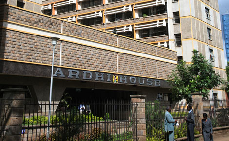
Why typewriter is necessary at Ardhi House

Loading Article...

For the best experience, please enable JavaScript in your browser settings.

By FT Odhiambo

Kenya: Many enterprising Kenyans, especially those eyeing government tenders, recently cried foul over a tender advertisement by the Lands Ministry for the supply of equipment that included typewriters. Many wondered why typewriters, now considered obsolete, are required in this digital era.

Probably unknown to many Kenyans, most government ministries and departments still operate manually. This is more pronounced in land transactions since the Lands Ministry is yet to fully embrace digital technology. A look at land transaction processes, from land data collection, processing, registration, storage and subsequent conveyance, are designed in a systematic way. Changing this to digital will be an up hill task.

To enable land management and administration, the most important basic step is the collection of geo-spatial   information. This is achieved through various survey methods such as geodetic, topographic, cadastral, hydrographic, engineering, mining, aerial and statistical surveys.

Once collected, the data is processed into useful information to meet the needs of various users, who require them after being mapped in either or both soft and hard copies. With advancement in technology, geo-spatial data collection and processing has undergone a lot of changes.

Classical   survey methods such as use of chain, triangulation, traditional   aerial photography, manual and semi-automated drafting, have been replaced with new technologies like electronic distance measuring (EDM), global positioning system (GPS), use of remotely sensed imagery, LIDAR system and digital plotters, which displays information on screen and archive them in micro-chips.

One area that is still lagging behind is the cadastral survey and mapping. This is one branch of surveying which is dear to many Kenyans as it results to land registration and issuance of title deeds.

An insight into collection and processing cadastral data can shed some light on why it is still stuck in a technological rut.

Cadastral data and information

In areas declared adjudication sections to determine rights and interest in an ancestral land, un-rectified aerial photographs are used for photo interpretation to identify features and enable determination of land parcel boundaries.

Due to lack of currency, obsolete information, together with new information on the ground, create confusion, thus affecting the adjudication process. The resultant cadastral maps are manually drawn and due to lack of co-ordinates, the errors are compounded.

The Land Adjudication Act is yet to be amended and reviewed to provide geo-referencing as required by the Land Registration Act 2012.

Cadastral survey in areas which have co-ordinates, automation and digitisation is still limited and does not meet the requirement of a digital government.

The use of classical survey chain, manual booking and plotting of survey data is still the norm. In land registries, several instruments numbering about 30 are used for land transaction processes. The transaction ranges from land transfers, leases, charges, partition, mutation, severance, to surrender. The instruments are predesigned   to enable filling in the required details by pen or typing for clarity purposes.

Those instruments are supposed to ease land transactions as opposed to other methods of drafting long land transaction instruments, which require legal expertise. After filling the predesigned instruments, it is then witnessed by a legal officer.

Due to shortage of the instruments, some people resort to photocopying to enable them do the transactions.

The land register, which is a classified document, is filled in by pen or typewriter. Title deeds, which are documents showing ownership rights to land, are still manual as the property and proprietorship sections are filled in by a typewriter.

As such, the typewriter is still a necessity in the land sector as it enables preparation of the land instruments and issuance of title deeds. The typewriter will only be phased out once the land sector goes fully  digital.

— The writer is a survey and mapping professional with Maptech Consult