For the best experience, please enable JavaScript in your browser settings.
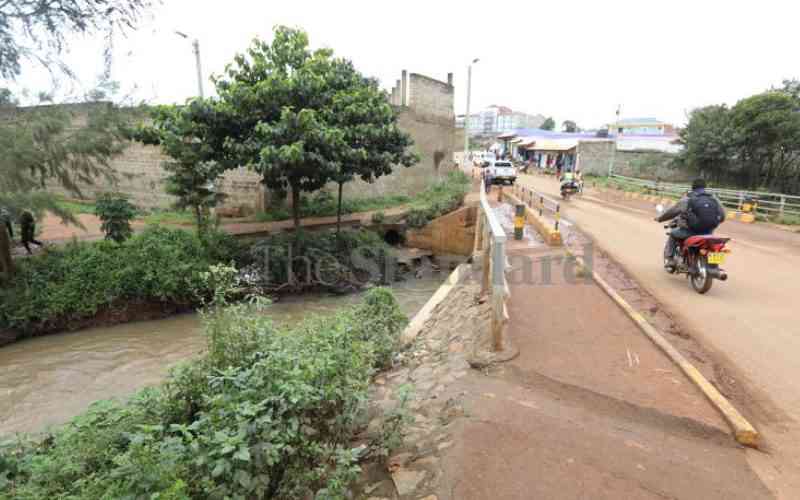
Lending institutions should be more vigilant and do due diligence when handling clients with property near streams, rivers, lakes and wetlands, a report has advised.
The report has also asked for amendments in laws to remove the confusion that sometimes results in banks exposing themselves to losses by funding developments in such areas.
The report by the Financial Sector Deepening Kenya (FSD) on environmental risk banks face in their business says disparities in environmental regulations, specifically riparian land zoning is not well articulated.
It cites, the interplay between zoning guidelines under the physical planning laws, environmental regulations and riparian rules which it says are not well defined and as such, land surveys and cadastral maps often don’t clearly demarcate expected riparian boundaries.
“There are several competing laws on the management and protection of riparian reserves,” says the recently released report through a collaborative effort with the Kenya Bankers Association (KBA), International Union for Conservation of Nature (IUCN) and Mitsubishi Corporation Fund for Europe and Africa (MCFEA).
KBA said in a statement on the study that the failure of land survey and cadastral maps to demarcate expected riparian boundaries has given way to real estate development being designed and constructed on riparian zones on the strengths of unmarked survey maps.
Social risks
The report documents the environmental and social risks to the banking sector whose eureka moment came in 2018 when over 4,000 buildings were earmarked for demolitions in Nairobi County.
“This was mainly attributed to the buildings being constructed on riparian land and road reserves,” the report says.
The earmarking of the 4,000 buildings for demolition was sparked by the collapse of a six-storey building in Huruma, Nairobi in April 2016 which killed 51 people. The incident happened during a downpour with the building having some of its structural pillars erected from at the banks of the Nairobi River.
It details that many of the buildings involved were developed before the enactment of the Environmental Management and Coordination Act (EMCA), 1999 - the principal legislation for the protection of various aspects of the environment.
“As such, a lot of the encroachment before 2000 may be attributed to a lack of regulation to guide the riparian reserves,” it adds.
The report notes that environmental and social risks are not explicitly defined in EMCA. As such several sectors are adversely affected by existing and emerging environmental risks. “The banking sector has been one of those exposed to various direct and indirect environmental and social risks,” the report says.
The 53-page report says while banks’ internal operations do not generate significant environmental and social impacts, they are exposed to the risks through the beneficiaries of the credit they advance to.
The report cites competing laws on the management and protection of riparian reserves, noting that the regulations indicate varying measures of the riparian width on the river, and wetland and determine the zone from different points of reference hence creating confusion.
Stay informed. Subscribe to our newsletter
For example, the Environmental Management and Co-ordination (water quality) Regulations, 2006 bars people from cultivating or undertaking any development activity within a minimum of six meters and a maximum of 30 meters from the highest ever recorded flood level, on either side of a river or stream, and as may be determined by the authority from time to time.
This is while the Water Resources Management Rules, 2007 states that unless otherwise determined by a Water Resources Inspector, the riparian land on each side of a watercourse shall be defined as a minimum of six meters or equal to the full width of the watercourse up to a maximum of 30 meters on either side of the bank.
High-water mark
The Survey Act Cap 299 on the other hand states that the Coast foreshore reservation - not less than 60 meters in width shall normally be reserved above the high-water mark while Tidal River reservations - not less than 30 meters in width above high-water with no mention of other rivers.
Lake reservations are not less than 30 metres in width from the water edge at ordinary high-water.
The Physical Planning (Subdivision) Regulation of 1998 provides that in a subdivision of land, way leaves or reserves along any river, stream or watercourse shall be provided of not less than 10 meters in width on each bank but it gives an exception in areas where there are established flooding.
“These amendments are viewed as adequate because they clearly define the distances and measurement points regarding riparian zones of streams, rivers, lakes, and wetlands,” it explains.
It also calls for review of amendments to the Environmental Management and Co-ordination (water quality) Regulations, 2006 Part II Sec 6, Water Resources Management Rules, 2007,116 (2), Survey Act Cap 299 Part XII, and Physical Planning (Subdivision) Regulation, 1998.
This is aimed at harmonising the definitions and measurements regarding protected riparian zones with the Environmental Management and Coordination (Conservation and Management of Wetlands) Amendment Regulations, 2017.