By WAHOME THUKU
THE HAGUE: The International Criminal Court (ICC) Prosecution hired an expert to gather evidence regarding the movements of Deputy President William Ruto and radio journalist Joshua Sang ahead of the 2007 post-election violence.
In particular, the prosecution was interested on the time it would take to fly or drive from Sang’s Kass FM offices in Nairobi to specific locations in Eldoret.
The Prosecution instructed American satellite imagery expert Lars Bromley to also research the time it would take to fly or drive to and from various points within Eldoret.
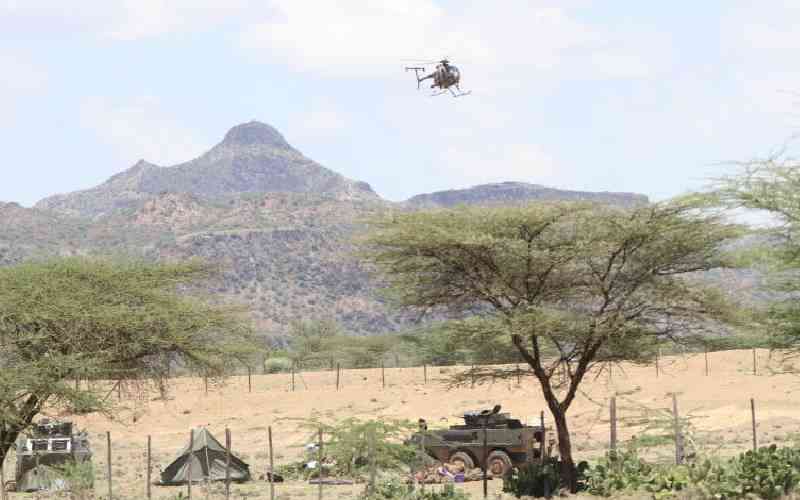
Bromley was asked to calculate the time it would take to fly by helicopter from Kipkaren Salient trading centre in Eldoret to Kass FM offices on Diani Road in Nairobi. He was asked to do the calculations for December 12, 2007, which was a few days before the elections.
The Prosecution claims that Sang was capable of flying from Nairobi soon after hosting a radio show to attend meetings with Ruto and other ODM allies in Eldoret, during which the violence was planned.
Bromley estimated that it would take between 63 minutes and 78 minutes to cover the distance depending on the speed of the aircraft. He estimated the time using a speed of between 200km/hr and 248km/hr.
The witness used models of Eurocopters to do the calculations. Yesterday, he told the court that he used local media sources to establish the common types of helicopters used in Kenya. The types of aircraft were not given to him by the Prosecution in 2012.
Bromley, an employee of the United Nations Operational Satellite Applications Programme, was concluding his evidence during the trial of Ruto and Sang in The Hague, Netherlands.
During cross-examination by Sang’s lawyer Katwa Kigen, the witness said the weight of the helicopter, its type, altitude and the temperature would probably affect the speed. Bromley said making estimates for road travel was complex due to factors such as traffic jam, weather conditions and type of vehicles used.
He, however, used a road network downloaded from Google maps in 2011 but was not sure if the roads existed in 2007 and did not see the actual ones. He was the second expert witness to testify in the case.
 The Standard Group Plc is a
multi-media organization with investments in media platforms spanning newspaper
print operations, television, radio broadcasting, digital and online services. The
Standard Group is recognized as a leading multi-media house in Kenya with a key
influence in matters of national and international interest.
The Standard Group Plc is a
multi-media organization with investments in media platforms spanning newspaper
print operations, television, radio broadcasting, digital and online services. The
Standard Group is recognized as a leading multi-media house in Kenya with a key
influence in matters of national and international interest.